DJI Matrice 4 Series in Action: Search & Rescue to Smart Cities
The
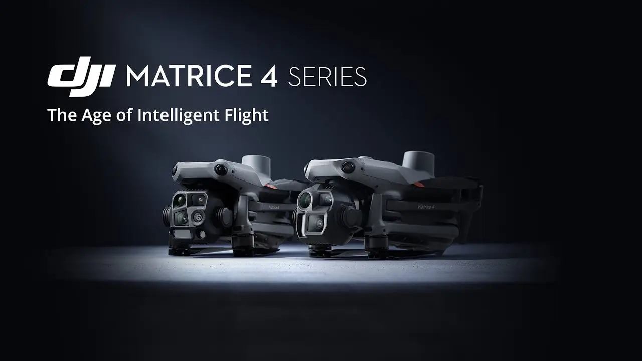
DJI Matrice 4 series represents a major development in enterprise drone
technology. It delivers speed, precision and versatility for critical missions.
The multi-sensor drone is targeted at industries like emergency response, civil
safety, geospatial mapping, and infrastructure inspection.
Keep reading to find out its role in search and rescue and
how it supports the development of smart cities.
A
Quick Overview of the DJI Matrice 4 Series
There
are two models, Matrice 4T and Matrice 4E. Both are available with advanced
imaging sensors, laser range finders, and powerful navigation systems. It
enables professionals to accomplish complicated tasks within record time.
The
drones come with improved low-light performance, enhanced stability, and
long-range transmission. Offered by DJI, one of the leading drone companies, it
has become a top choice for professional solutions.
The Major
Features of the DJI Matrice 4 Series
The
following sections provide an overview of the key offerings of the DJI Matrice 4 Series.
·
Smart Design for Important Missions
Matrice
4 Series is designed to overcome difficult operating conditions. It is equipped
with omnidirectional low-light fisheye vision sensors, which means it is safe
to navigate both in a complex urban environment and distant lands.
The
thermal imaging and NIR auxiliary light on the 4T model are ideal for searching
and rescuing. The 4E is ideal with its advanced mechanical shutter and 0.5-second-interval
shooting processes that are useful in situations that involve high-accuracy
mapping.
Such
intelligent design features enable each mission to be conducted as efficiently
as possible by ensuring that optimum results are achieved. For any commercial
drone operation requiring reliability and adaptability, this series delivers
unmatched results.
·
Increasing Search and Rescue Response
In
emergency missions like the search for missing persons, evaluation of areas hit
by a disaster, slip-ups and sluggishness are unacceptable. The drone offers
speed and accuracy.
The
Matrice 4T has a thermal camera that is able to recognise heat signatures
across smoke, fog, or darkness. The medium telephoto lens provides clear visual
information at impressive distances.
The
Night Scene Mode allows operations to go on as usual. It enables one to track a
moving subject automatically. As a result, search teams no longer have to
concentrate on controlling the camera manually and can focus on the decision-making
process.
These capabilities make the DJI Matrice 4 series a powerful asset for emergency services and humanitarian missions.
The Remodeling of Smart City
Surveillance & Planning
Smart
cities rely on real-time information, accurate mapping and effective monitoring
of structures. The 5 directions oblique capture and Smart 3D capture feature of
the Matrice 4E make it possible to quickly formulate detailed urban models.
This
cannot be overemphasised in the planning of traffic flow, inspection of
infrastructure and environmental surveillance. Cities are able to receive
active, accurate, actionable information at a high speed of 0.5 seconds with
mapping speeds of up to 21 metres per second.
For
drone companies involved in urban development, the ability to integrate live
aerial intelligence into planning workflows is a game-changer. And DJI's Matric
4 Series offers just that.
Correct Imaging and Measurement Capabilities
Regardless
of whether it is to conduct a construction survey or a rescue operation,
accuracy is something that cannot be bargained for. The drone has an integrated
laser measurement finder that is able to make real-time measurements that are
immensely accurate.
It
allows professionals to mark where to survey, estimate areas and relay such
information to the ground teams in real time. 48MP on the telephoto camera
allows the user to see all structural details even hundreds of metres away.
Electronic
dehazing technology allows clear imagery in challenging weather, further
enhancing the operational versatility of the commercial drone.
Better Low-Light and Night Operations
The
Matrice 4 Series has one of the most impressive features; low-light capability.
Able to fly in less-than-ideal conditions, it can produce clear imaging in
darkness and various weather conditions.
It
makes night-time inspections, surveillance or monitoring of wildlife quick and
efficient. Urban settings, where low-light obstacle sensing offers additional
measures of operational security due to low-light conditions, are another area
of operation where it is able to provide efficiency.
Workflow and Real-time Transmission
The
O4 Enterprise video transmission system is also presented in a 25 km range with
minimal latency, thus the data is available to the decision-makers promptly.
The DJI Cellular Dongle 2 is a fix for stable connectivity in remote regions
where there would otherwise be no traditional network coverage.
The
series is also compatible with DJI Pilot 2 and DJI Terra, allowing a seamless
way of flight planning, mission execution, and analysis. This end-to-end
integration is another key reason the Matrice 4 Series stands out for
enterprise-level tasks.
Application Across Different Industries
The
usage of the Matrice 4 Series is not restricted to search and rescue missions
or urban planning by far. It allows accurate crop observation and irrigation
scheduling, which are applicable in the farm. In the field of energy, it helps
to examine the power lines and substations.
It
is used by forestry conservation departments when observing the wildlife
habitats and by construction departments in their mapping solutions to observe
their areas of construction. Such adaptability positions the DJI Matrice 4
series as an essential tool for industries requiring high-accuracy aerial
intelligence.
Superior Safety Measures in the High-Speed
Mode
Fast
work and complicated conditions demand high-quality safety systems.
Omnidirectional obstacle sensing, smart rerouting, as well as terrain following
features of the Matrice 4 Series make every flight quick and safe.
Automatic
Return-to-Home and Waypoint programming also enhances the efficiency of
operation, especially when the same operation is required over and over. For
commercial drone pilots, these features mean greater confidence in challenging
scenarios.
Conclusion
The
DJI Matrice 4 series sets a new standard for what enterprise drones will be
capable of. Its combination of speed, precision and flexibility has achieved
the level required by a variety of industries. Its powerful imaging solutions,
extended range of transmission, as well as smart safety solutions make it more
than an aerial tool.
It
is a fully integrated operating solution. Whether it is search and rescue operations
or how to make cities of the future, this series enables professional teams to
operate with the highest efficiency.
