Pix4DMatic Explained: Powerful Desktop Mapping for Professionals
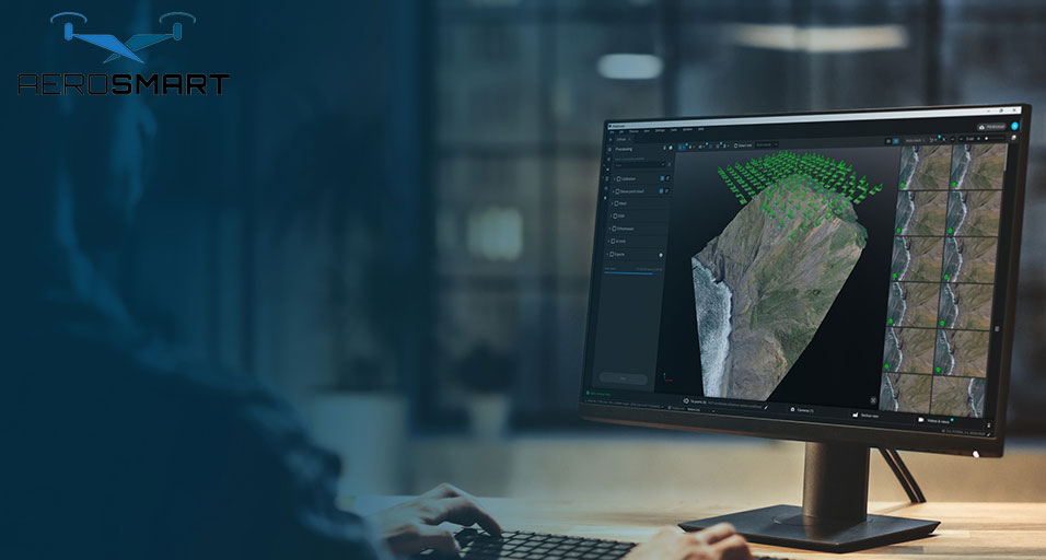
Turning raw aerial data into usable, understandable
data is what most projects across industries demand. This is when Pix4Dmatic is
the best option. With the effective use of desktop mapping, it is easy to
process aerial or other imagery into insightful ones using a desktop or laptop.
These are products such as 3D models, digital surface, and point clouds. It
involves the use of images, and the data is used for thorough surveys and
analysis in specific project works. The Pix4Dmatic is a software suite that
streamlines effective data processing.
The advanced software helps address the challenges of
a data mapping solution that should ensure accuracy and speedy delivery. It
ensures the data is suitable for use in the workflow and removes the complexity
of hard-to-read data. So, professionals across various industries can invest in
this software that makes drone data processing easier than before.
With this, data processing takes less time, and it is
easy to move from the initial capture to its analysis, without leaving any
loopholes. Let us take a look at how Pix4Dmatic supports powerful data mapping,
helping professionals achieve precision. It helps break the data into a simpler
form, one pixel at a time, and ensures professionals can use it effectively for
businesses.
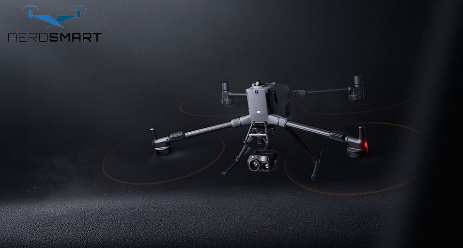
How does Pix4Dmatic work with the Modern Drone system?
The software is designed for hassle-free integration
with modern drone systems. The efficiency supports the ease of the
photogrammetry workflow, without making things complex. This is why software is
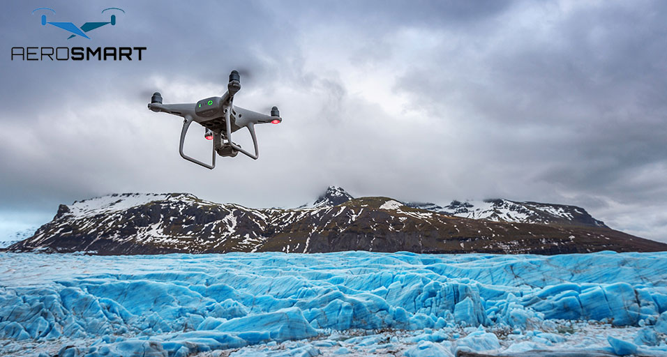
the best thing professionals can adopt. It helps handle advanced aerial systems,
including DJI drones. Such an effective system setup is what users can rely on
to get dependable data converted from its raw form into usable outputs.
How is the Software Unique from Traditional Mapping?
The software is designed to handle modern mapping
needs in a project. The traditional mapping software faced challenges and
couldn't handle a large volume of data. It is about effectively converting raw
data into actionable information. These are high-end data captured by a drone
and help users to get quality images for easy and effective processing in a
project.
The desktop approach helps the experts to get full
control of data. This further ensures that experts can easily manage and refine
data as required while having ownership of a project file and using it as
required. Traditional mapping has limitations that the latest software can
overcome and allow the experts to get full data control, from start to end, in
a project.
Software Built To Process Drone Data
As drone models advance, drone sensors become more
precise and efficient. It is becoming a must-have in aerial imaging projects.
When professionals struggle to analyse data precisely for a project, this
advanced software can make data conversion easier than before.
The amount of data captured increases with advanced
sensors that can be captured in a single flight. This increases work
efficiency, ensuring consistent performance. It can process large images and
easily handle cloud points, surface models, and more.
With an advanced mechanism, the software and drone
system are expected to process faster and with greater data accuracy. This is
when Pix4Dmatic can effectively balance algorithm processing and reduce the
service time. It helps maintain data integrity and can still project deadlines
without compromising data quality.
From planning to performance and reporting, it
provides excellent data precision for various projects. Data extraction is
about extracting distance, volume, or elevation effectively, and the best
software system can help professionals achieve outcomes that reflect real-world
conditions.
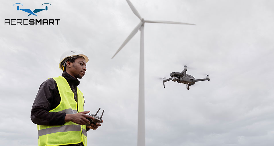
What are the DJI Drones Useful For in the UAE?
The DJI drones and the software mentioned above are
useful for inspection, construction and surveying projects. It helps craft
terrain models, measure construction spaces, check construction site progress,
and compare data over a given time limit. This makes it easier for experts to
analyse data structures and ensure proper details are used to achieve clarity
in project work. It is crucial in high-end projects, and adopting Pix4Dmatic
can help scale up various projects.
Professionals can have flexibility in choosing the
software and drone models best suited to a particular project. So, you need to
look for an efficient DJI drones UAE company that can provide the best software
and hardware setup to use in high-end projects, required for data
processing.
The latest feature-rich drones ensure seamless
integration with other software systems, making data processing easier. It
strengthens the entire workflow and helps from the flight plans to the final
execution, ensuring efficiency and accuracy at every stage. This is crucial to
ensure a proper outcome in a high-end, small-scale industrial project.
Is it Possible to use a Setup for Long-term
professional Use?
Pix4DMatic is designed for sustained professional use
rather than one-off tasks. The consistency and reliable outputs make the
software suite perfect for long-term projects, and so, it is better to get products
from a reputable company of DJI drones UAE. It reduces the need for rework and boosts
a project's efficiency.
The software is an important part of industrial
projects that need precise use of drone-captured images. It boosts the ease of
the mapping task and can deliver high-quality results to maintain quality
standards across projects. Set the right software suite from the initial stage
to achieve effective results.
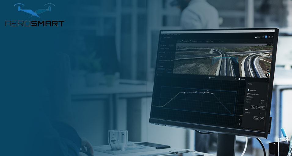
Tool for Professional Mapping Work
Mapping success is about choosing the right,
up-to-date hardware and software. It is a high-end drone with advanced software
that speeds up and simplifies data processing. Pix4Dmatic can meet
professional-grade image expectations and is easy to use. The engineers,
surveyors and designers
With Pix4Dmatic it is easy to get quick data for desktop
mapping and get details on how it's progressing. It can easily handle drone
data, making the workflow easier. The software makes data processing easier,
even in places with limited connectivity, and ensures it doesn't disrupt
project delivery. This software stands out as a practical and prominent
solution to handle various industrial projects.
Author Bio
Aerosmart is an authentic drone solutions provider in
the UAE, to help industries with a hardware and software suite. It gives excellent
after-sales service to professionals. It focuses on precision and compliance to
ensure proper workflows across various UAE projects. This can help make the
best use of the drone technology for diverse surveying, mapping, and inspection
tasks.
FAQs
1. Who Should Use Pix4Dmatic with DJI Drones?
Pix4Dmatic is for construction, inspection, surveying
and engineering projects. It supports effective and fast data mapping from
drone images, without compromising the end results in projects.
2. Can I Use DJI Drone with Pix4Dmatic?
DJI drones with Pix4Dmatic remain an excellent
combination to process data in various industrial work, from surveying to
engineered solutions to inspection and others. It helps get high-quality,
accurate aerial images.
3. Is it Suitable To Use Large Drone Data With
Pix4Dmatic?
You can use a high-resolution image with Pix4Dmatic
and process it accurately, a task that traditional mapping software often fails
to achieve. It also impacts the data processing speed and efficiency.
4. How is Desktop Mapping Helpful?
Desktop processing helps in mapping with accurate data
security and control, and in maintaining data reliability. This combination is
also useful to handle sensitive and time-sensitive data and maintain a
consistent workflow.
5. Can I Get Accuracy in Results for Repeated Tasks?
Pix4Dmatic can properly access the parameters from the
available data. Professionals can get output that helps in monitoring and
inspection tasks. This makes the whole analysis effective.
6. Is it Effective to Use Pix4Dmatic with Other
Software?
The use of advanced software reduces the need for
third-party sources This is when team members have better control over data
processing and security measures.
Recent Posts


About
Empowering industries with cutting-edge drone technology, DJI Enterprise solutions, and expert support across the UAE and beyond.
Contacts
-
Address
Office 203, Al Tayer Commercial Building, Rolla Street, Bur Dubai, UAE
-
Phone
+9714 2238380 / +97150 157 6093
-
Email
-
Whatsapp
My Account
Customer Service
Subscribe to our newsletter for regular updates about Offers, Coupons & more
Follow Us
Empowering industries with cutting-edge drone technology, DJI Enterprise solutions, and expert support across the UAE and beyond.
-
Address
Office 203, Al Tayer Commercial Building, Rolla Street, Bur Dubai, UAE
-
Phone
+9714 2238380 / +97150 157 6093
-
Email
-
Whatsapp
