The Role of DJI Drones in Infrastructure Development in Chad

Infrastructure in Central Africa, especially in Chad, is currently
growing at lightning speed. The country needs better roads, bridges, and
utility networks to connect communities. This is where DJI Drones deliver benefits by shaping construction teams'
approach.
These aerial systems offer overhead views alongside data collection
capabilities. Engineers can plan superior road networks while monitoring construction
sites in remote locations. The technology delivers time savings. At the same
time, it reduces cost while elevating safety standards across projects.
DJI Drones in Chad's Infrastructure Development Overview
Building anything in Chad comes with challenges. The landscape is quite
hard to access. The wide terrain alongside sparse road networks makes surveying
methods time-consuming. Getting survey crews to remote sites increases the cost.
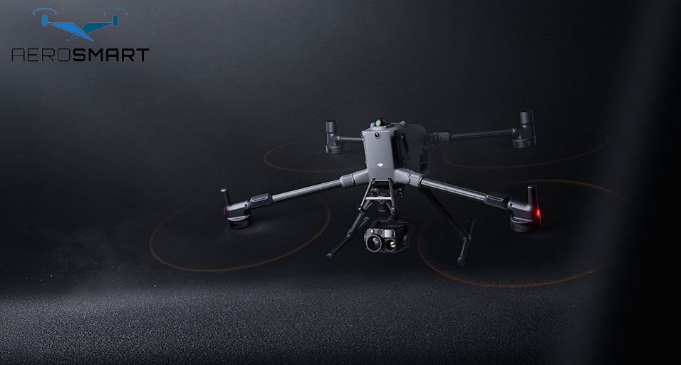
DJI Drones
changed that equation. A small team with the right equipment covers areas that
used to take weeks. The cameras shoot high-resolution photos from
three-dimensional angles. Here's what they do-
- Survey the land before construction
starts
- Track how projects move along
- Check bridges and roads for damage
- Map out routes for power lines
- Record everything for stakeholders
Local drone dealers
stock different models now. A few handle basic photography while others run
inspections. The dealers now
supply models suited for various infrastructure needs. The devices range from
basic mapping tools to inspection systems. Teams now select equipment based on
project demands and budget constraints.
Why Choose DJI Drones in Infrastructure Development in Chad?
The best drone company in Chad teams rely on DJI for a few good reasons. These devices deliver excellent performance under difficult conditions. What they do is reduce project expenditures when compared to conventional techniques.
Site Surveying and Mapping
Ground surveys across Chad's expansive landscapes can take weeks to
complete. DJI Drones accomplish
the same work in days. Note that pilots follow prearranged routes while cameras
capture beautiful images.
Photogrammetry software processes these images into maps. Engineers receive
accurate topographic data and terrain features. So, they don't need to guess
about elevations anymore. The maps also speed up design work.
That level of detail helps prevent mistakes. You see where water
runs during the rain. You spot soft ground that won't support heavy loads.
Problems are spotted on paper rather than after the concrete gets poured.
Road Construction Monitoring
Building roads in Chad requires constant oversight. You need to
ensure that conventional inspections are conducted and that you drive to
distant sites every day. DJI Drones offer daily updates without the need
to travel.
Drones give you eyes on the whole project at once. A quick flight
shows what happened since last week. You spot issues before they turn into
expensive fixes.
The footage is useful for more than quality control. It settles
arguments about who did what and when. Everyone sees the same evidence.
Disputes drop off when the record is clear.
Project managers appreciate the time savings. Instead of spending
days in a truck, they review footage over coffee. Decisions happen faster.
Bridge Inspection and Maintenance
Checking bridges used to mean ropes and harnesses. Inspectors
climbed around looking for cracks and rust. Dangerous work that took days per
structure.
DJI Drones
get up close without the risk. The camera zooms in on connections and support
beams. Engineers can check the problems that might be hidden from a quick
ground inspection by identifying cracks or corrosion.
Thermal imaging adds another layer. Water trapped inside concrete
shows up as temperature differences. Catching that early stops bigger damage
down the line. This protects inspectors while offering superior data. Teams can
address minor issues before they require any expensive repairs.
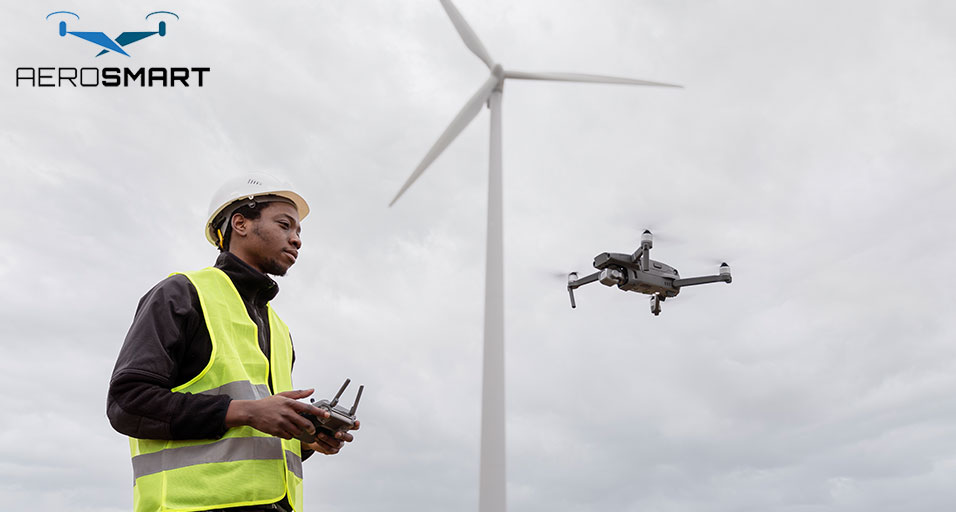
Utility Line Planning
Running power lines across Chad isn't simple. Planning these routes
requires an insight into the terrain conditions to avoid obstacles while
following a practical path. Ground surveys may overlook significant details.
Aerial mapping can reveal the entire story. You see the terrain
between point A and point B. Trees that would interfere are clearly visible.
Buildings and terrain features that complicate installation get mapped out.
That information saves money during construction. Crews know exactly
what they're dealing with before showing up. Equipment and materials match the
actual conditions. The planning phase becomes speedier.
Stockpile Volume Calculations
Construction sites pile up materials such as gravel, sand or concrete
aggregates. Understanding the quantities can prevent shortages while
controlling the expense.
Drones measure volumes from above. The software performs
calculations that account for shape and size. You get accurate volumes without having
to climb around with measuring tapes.
Knowing exact amounts improves ordering. You buy what the project
needs instead of padding orders to be safe. Material costs drop when waste
drops. Tracking inventory becomes routine. Weekly flights show what got used.
Managers reorder at the right time to keep work moving.
Environmental Impact Assessment
Building changes the landscape. Chad requires effective monitoring
techniques to protect natural areas during construction. On that note, drone
footage documents conditions before the work starts. Regular flights during
construction show changes as they happen. Comparing images over time creates a
clear record.
You will get an idea when vegetation gets damaged, or when water
patterns change. Problems get addressed before they violate regulations. That
protects the environment and keeps projects compliant.
The visual record also helps with permits. Authorities want proof
that protections are working. Drone data provides that proof without argument.
Emergency Response Planning
Natural calamities may damage infrastructure. Floods wash out roads,
and storms damage bridges. Getting assessment teams to affected areas takes
time, and you wouldn't have the time for it during emergencies.
DJI Drones
deploy within hours. They survey damage while roads are still blocked.
Responders get detailed views of conditions within hours instead of days.
That speed matters for planning repairs. Resources go where they'll
do the most good. Communities get reconnected faster because decisions are
based on solid information.
The aerial perspective shows connections that ground teams miss. A
washed-out culvert two kilometres away might be causing problems at your site.
Drones spot those links.
Quality Control Documentation
Proving work was done as per the specifications can protect everyone
involved in the work. Contractors need evidence that they complied with the
specifications. Clients want confirmation that they got what they paid for.
Photos from ground level miss too much. Drone dealers provide equipment that captures complete
documentation. Each phase of construction gets recorded from above.
The timestamps on any footage settle timeline questions. The record
shows the truth if someone claims work was delayed. Disputes get resolved with
facts instead of opinions. Projects finish more smoothly while payment happens
faster.
Concluding Thoughts
Thus, you now know that infrastructure in Chad gets improved with DJI drones. It delivers significant
benefits. Hence, selecting aerial capabilities improves Chad's construction
sector.
FAQs
Can drones operate in Chad's hot climate conditions?
Yes, though batteries work best at temperatures below 40 degrees
Celsius. Teams fly early in the morning when possible. Modern DJI models handle
heat better than older equipment.
What training do operators need to fly infrastructure drones?
Basic flying takes one to two weeks of practice. Specialised work,
such as mapping, requires additional training. Many sellers include instructions
with equipment.
How accurate are drone surveys compared to traditional methods?
Good drones hit 2-3 centimetre accuracy with proper setup. That
matches traditional surveying while covering more ground faster. The speed
advantage is huge on large sites.
What happens to drone data after collection?
Images are processed by software that builds maps as well as 3D
models. Final files work with standard engineering programmes. Data gets stored
according to project requirements.
Do drones work for nighttime construction monitoring?
Models with thermal cameras do. They're great for monitoring
concrete pours that happen after dark. Regular cameras need daylight or bright
work lights.
How long can infrastructure drones stay airborne?
Flight time ranges from 25 to 45 minutes, depending on the model and
what it's carrying. Professional crews use multiple battery packs for longer
coverage. Most surveys fit within available battery life.
Recent Posts


About
Empowering industries with cutting-edge drone technology, DJI Enterprise solutions, and expert support across the UAE and beyond.
Contacts
-
Address
Office 203, Al Tayer Commercial Building, Rolla Street, Bur Dubai, UAE
-
Phone
+9714 2238380 / +97150 157 6093
-
Email
-
Whatsapp
My Account
Customer Service
Subscribe to our newsletter for regular updates about Offers, Coupons & more
Follow Us
Empowering industries with cutting-edge drone technology, DJI Enterprise solutions, and expert support across the UAE and beyond.
-
Address
Office 203, Al Tayer Commercial Building, Rolla Street, Bur Dubai, UAE
-
Phone
+9714 2238380 / +97150 157 6093
-
Email
-
Whatsapp
