Mapping Drone Solutions
The race to map better
There’s no denying the fact that the process of mapping has become hugely advanced due to the induction of drones and the post-mapping data available to operators. Mapping drone solutions have come a long way with highly advanced payloads that make land surveys, photogrammetry, 3D mapping, topographic surveying, and more, not just easier but extremely efficient and reliable. Here’s a look at the mapping drone solutions we offer.
WingtraOne
Redefining standards in aerial surveying
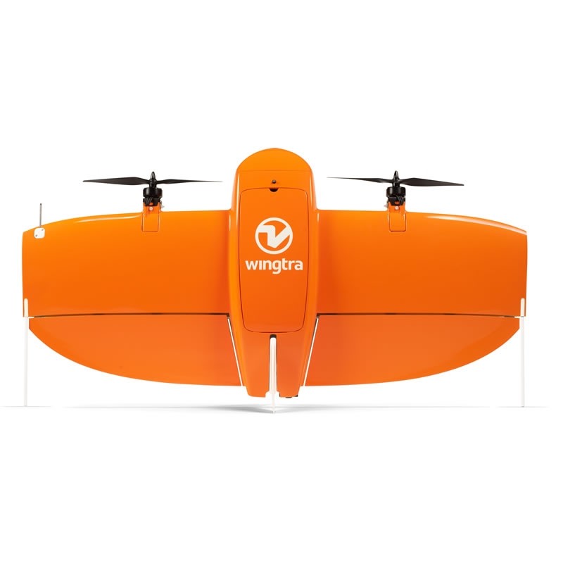
As part of providing ideal mapping drone solution, the WingtraOne VTOL mapping drone is capable of performing fast aerial surveys across wide or hard-to-reach areas and producing reliable maps with unparalleled resolution and accuracy.
senseFly eBee X
The senseFly eBee X is a fixed-wing drone that is used comprehensively for mapping requirements. Designed to enhance the quality, efficiency, and safety of data collection, the eBee X has a camera to cater to every job, and it comes with the accuracy and coverage to meet the requirements of every project.
Efficient & Precise
A maximum flight time of 90 mins for vast coverage of up to 500 ha (1,235 ac) at 400 ft. High-Precision on Demand helps you achieve absolute accuracy of down to 3 cm (1.2 in), without GCPs.
Rugged & Reliable
The senseFly eBee X allows you to work at virtually every site, no matter how demanding, due to its Steep Landing technology, robust design, live air traffic data, and more. You can also be assured of senseFly’s trusted professional, local support.
Multi-purpose
The senseFly eBee X suits every job thanks to its range of groundbreaking cameras. These include the new senseFly S.O.D.A. 3D, for stunning 3D reconstructions of vertical environments, the best-in-class senseFly Aeria X RGB photogrammetry camera and the senseFly Duet T for creating geo-accurate thermal maps.

For mapping drone solutions, the WingtraOne drone comes equipped with a choice of Sony high-resolution mapping cameras or a professional multispectral camera by Micasense. Cameras can easily be exchanged in the field, making the same drone suitable for different applications. Using the intuitive flight planning software and the fully autonomous flying operations, surveyors can capture geo-tagged aerial images with virtually no piloting skills.
WingtraOne’s drone image outputs can be processed by all major photogrammetry software to create highly-accurate orthomosaics and 3D models.
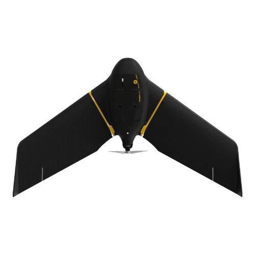
senseFly eBee Geo
The senseFly eBee Geo is an affordable fixed-wing mapping drone designed to meet the highest demands of surveyors, civil engineers and GIS professionals worldwide. eBee Geo is rugged, intuitive to operate and makes surveying and mapping small to large areas faster and more efficient than using terrestrial surveying equipment alone.
The data collected can quickly be processed into highly-accurate georeferenced orthomosaics, digital elevation models, digital surface models and high-density point clouds to bring additional value beyond common vectors. eBee Geo comes with everything you need to get started, including professional drone camera technology and eMotion, senseFly’s proven flight planning software.
Lightweight yet incredibly durable, it’s designed to operate in the harshest conditions, thanks to its optimized airframe and ultra-tough under-body skin. With eBee Geo, you can map up to 160 ha (395 ac) at 120 m (400 ft) with a maximum flight time of 45 minutes. eBee Geo is also available with real-time kinematic (RTK) positioning.
Drone mapping solutions can help every surveyor and GIS professional map safer and smarter. With eBee Geo, you can all of those benefits into one affordable fixed-wing mapping drone package.
The result is a rugged and efficient drone suited to even the most demanding missions. Its professional camera or Sensor Optimized for Drone Applications (S.O.D.A.) ensures sharp, accurate mapping outputs, and eBee Geo’s streamlined and automated flights make mapping easy, scalable and affordable.
About
Empowering industries with cutting-edge drone technology, DJI Enterprise solutions, and expert support across the UAE and beyond.
Contacts
-
Address
Office 203, Al Tayer Commercial Building, Rolla Street, Bur Dubai, UAE
-
Phone
+9714 2238380 / +97150 157 6093
-
Email
-
Whatsapp
My Account
Customer Service
Subscribe to our newsletter for regular updates about Offers, Coupons & more
Follow Us
Empowering industries with cutting-edge drone technology, DJI Enterprise solutions, and expert support across the UAE and beyond.
-
Address
Office 203, Al Tayer Commercial Building, Rolla Street, Bur Dubai, UAE
-
Phone
+9714 2238380 / +97150 157 6093
-
Email
-
Whatsapp
