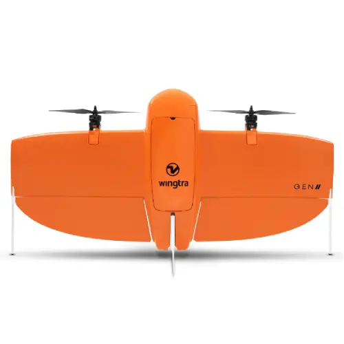

WingtraOne Mapping Drone GENII
WingtraOne Gen II
WingtraOne GEN II features the most advanced reliability in surveying drones with vertical takeoff and landing for any complex enviornment. This is the key to maximizing drone uptime, boosting your productivity, and ensuring you deliver consistently.https://www.aerosmart.ae/mapping-drone/Predictive maintenance
WingtraOne GEN II intelligent algorithms continuously analyze all critical flight components before and during the flight.
Smart notifications
WingtraPilot can then notify you of any potential malfunction before it even occurs so that you can always fly with the safest equipment.
One drone to map it all
The payload range now includes an oblique camera for the most detailed 3D reconstructionhttps://www.pix4d.com/ and a built-in PPK GNSS receiver for each camera, allowing you to take on a wider array of missions with centimeter-level accuracy.
Oblique Sony a6100
Mounted on a tilted axis, this wide-angle camera is optimized for mapping vertical structures, allowing you to generate high-resolution 3D meshes.
- 24MP resolution
- GSD down to 1.6 cm/px, 0.6 in/px
- Tiltedmount
- Fast triggering
- Wide angle
- 12 mm optics
To map 3D structures such as buildings, you need to capture enough detail on the vertical walls.
High-resolution 3D meshes with centimeter-level absolute accuracy
Combined with WingtraOne’s unprecedented absolute accuracy and wide coverage, you can create stunning digital twins of single buildings or full-scale cities with the best absolute accuracy in a short time.
Horizontal absolute accuracy
down to
2 cm/px, 0.8 in/px Vertical absolute accuracy down to 4 cm/px 1.6 in/px
Zurich digital twin
Explore this high-fidelity digital twin of the city of Zurich that was generated using a WingtraOne GEN II, a Sony a6100 Oblique camera, and Bentley’s ContextCapture software.
Explore 3D modelwith Bentley ContextCapture
Explore 3D modelwith Esri Site Scan
Recommended software
Wingtra tested and recommends this software for optimal handling of WingtraOne’s high-resolution images and best 3D reconstruction results.
- Bently
- esri
PPK on every drone, for every camera
All cameras, including the multispectral, now benefit from the built-in multi-frequency L1/L2 PPK GNSS receiver.
Get centimeter-level* absolute accuracy without ground control points (GCPs) for any type of mission.
PPK with multispectral cameras
The tight integration of the camera with the drone and the PPK GNSS receiver ensures seamless stitching.
The integrated daylight sensors for radiometric calibration (for both cameras) and for thermal calibration (for MicaSense Altum only) ensure flawless quality data.
MicaSense RedEdge-MX
- Agriculture
- Environmental monitoring
- Premium multispectral camera, which combines a panchromatic sensor with five narrow bands to produce high-resolution multispectral and RGB from one flight.
MicaSense Altum
- Mining exploration
- Environmental research
- Forestry
- Precision agriculture
- High-resolution, narrow, 5-band multispectral data with a synchronized thermal band in a single flight to generate orthomosaics, low resolution thermal maps, vegetation indexes, and false-color composites.
- Remote ID ready
The WingtraOne GEN II is equipped with a WiFi module that ensures full compliance with existing and upcoming Remote ID regulations.
Enhanced landing accuracy
New navigation and heading unit (NHU) improve GNSS accuracy and boost the landing accuracy of the WingtraOne down to 2 m.
Landing accuracy 2×2 m (6.6 x 6.6 ft)
Extended Services
To further maximize your uptime under any circumstances, we developed the best support a surveying drone has to offer.
Reviews & Ratings
Related products


DJI Matrice 30T With BS30

DJI Agras T30 Intelligent Battery

DJI Phantom 4 RTK

DJI Agras T10

DJI Agras T10 Spreading Tank

DJI Agras T10 Intelligent Flight Battery

DJI Agras T10 Intelligent Battery Charger


DJI Agras T30
Product Queries (0)
Login or Registerto submit your questions to seller
Other Questions
No none asked to seller yet
Top Selling Products

Osmo Pocket 3 Creater Combo


DJI Matrice 4 Series Battery


Top Selling Products
Osmo Pocket 3 Creater Combo
DJI Matrice 4 Series Battery
About
Contacts
-
Address
Office 203, Al Tayer Commercial Building, Rolla Street, Bur Dubai, UAE
-
Phone
+9714 2238380 / +97150 157 6093
-
Email
-
Whatsapp
My Account
Customer Service
Subscribe to our newsletter for regular updates about Offers, Coupons & more
Follow Us
-
Address
Office 203, Al Tayer Commercial Building, Rolla Street, Bur Dubai, UAE
-
Phone
+9714 2238380 / +97150 157 6093
-
Email
-
Whatsapp