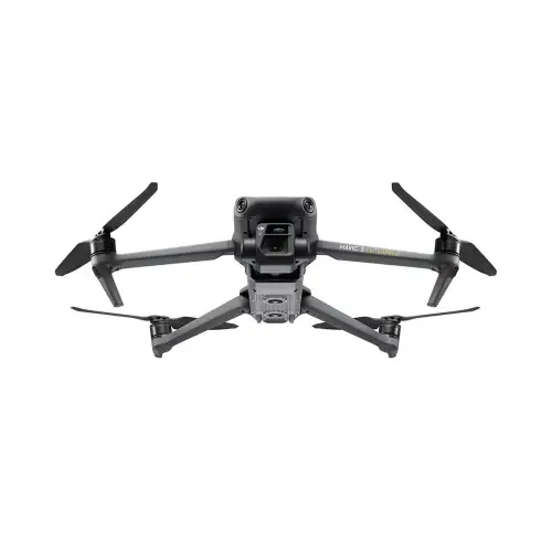
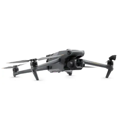
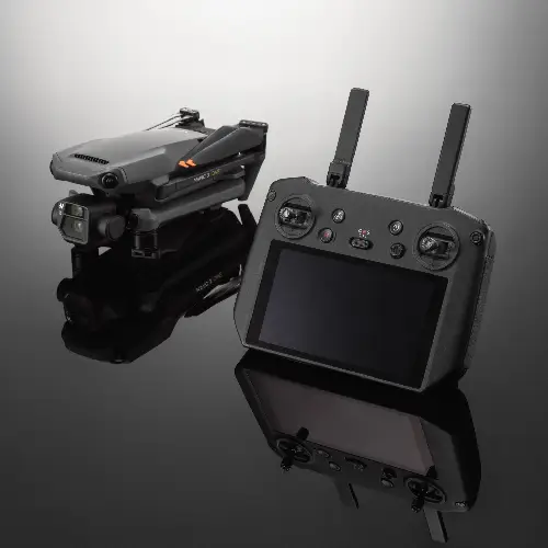
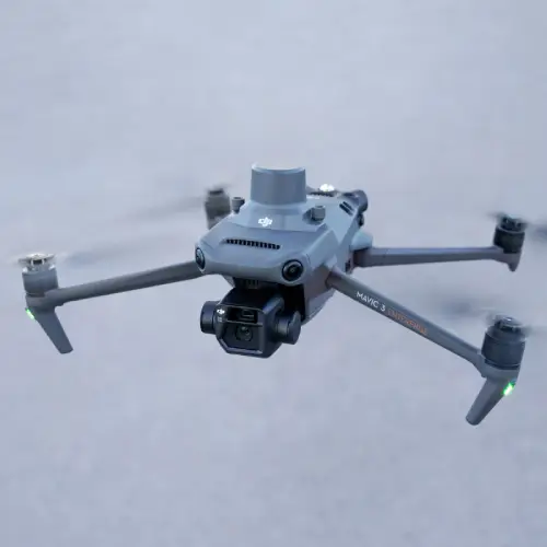
DJI Mavic 3 Enterprise Series — Your Everyday Commercial Drone
The DJI Mavic 3 Enterprise series is the most compact and portable in DJI Enterprise line up, and the Mavic 3 Enterprise series of drones are making a powerful impact despite its size and its the best first responder drone in many complex Scenarios. Mavic 3E series of drones are widely used for mapping surveying, public safety, crowd monitoring, search and rescue, inspection in small areas due to its ease of use and portability, which is weighing just 915 grams thus makes the drone more convenient to use and easy deployment without losing any important deadlines.
DJI Mavic 3 Enterprise comes with an integrated dual camera which has wide and zoom capability, DJI Mavic 3E can cover up to 2 square KM in single flight time as it provides 45 minutes flight time. combining the DJI Mavic 3 Enterprise series with RTK module, DRTK-2 Station can provide a centimeter level accuracy geo image. combing with DJI Terra can create the best 2D/3D models for various scenarios, like lands, building, Assests etc.
Key Features
- Imaging Superiority: The Mavic 3E is equipped with a breathtaking 4/3 CMOS wide camera (20MP) power, this can capture incredibly detailed and visually appealing images & high-quality videos. The F3 comes with a mechanical shutter, and lets you fly mapping missions quickly, without motion blur effects and most of the time also does not require Ground Control Points. The Mavic 3T has a thermal camera, or who else would like to use this in order salvo when fighting fire with its ability for users working late into night that going unnoticed.
- Advanced Zoom Capabilities: The Mavic 3E and 3T are equipped with a high-resolution zoom camera, which includes superior capabilities to an equivalent mounted lens in the same class. The power of this zoom function is that it enables you to inspect the things which are hard for reachability and still take engineering core parts from a safe distance, work wonders in infrastructure inspections and other such precision tasks.
- Extended Flight Time and Efficient Operations: Benefit from up to 45 minutes of flight time, covering more ground with each battery and expediting job completion. The battery system is also rechargeable, and they can be recharged very quickly so that your drone will always be full of power.
- Maximum Safety with Omnidirectional Sensing: The Mavic 3 Enterprise Series has omnidirectional obstacle sensing, including wide-angle lenses on all sides that can detect obstacles in real time and automatically avoid them. This guarantees secure & stable flight in even the most complex surroundings.
- Real-time Data & Reliable Transmission: The O3 Enterprise Transmission system ensures secure, wide-range coverage allows you to have steady live feed. This advanced image transmission technology is necessary when driving under challenging conditions as well.
- Intelligent Flight and Mission Planning: The Mavic 3 Enterprise features advanced flight modes, including Real-Time Terrain Follow, Smart Oblique Capture for accurate 3D modeling, Corridor Mission Planning for linear surveys. These facilities streamline the delivery of challenging missions and enhance general operational productivity.
DJI Mavic 3E
Wide Camera:
- 4/3 CMOS, 20MP, Mechanical Shutter
Tele- Camera:
- Equivalent Focal Length: 162mm, 12MP, 56× Hybrid Zoom
Premium Camera Performance
- Rapidly Survey: The Mavic 3E's wide-angle, in-motion mechanical shutter 4/3 CMOS sensor with TLV-ISO range of up to ~6400 and standard ISO from NDVI (Normalized Difference Vegetation Index) all the way through Full-Spectrum captures images at speeds as fast as ever.7 seconds interval. Conduct mapping missions with exceptional efficiency - without the need for Ground Control Points on-demand.
- Improved Low-Light Performance: The Mavic 3E's Wide camera features large 3.33μm pixels that, coupled with its intelligent low-light mode.
- Focus and Find: Featuring a 12MP Zoom Camera on both drones, Mavic 3E and Mavic 3T work with up to a combined Max Hybrid Zoom of up to ×56 allowing operators capture crucial details at range.
- Find the Unseen: The 640×512 thermal camera can perform point/area temperature measurement; high-temperature alarm, color palette, and isotherm are supported to assist you in locating targets in no time and guiding decisions.
- Simultaneous Split-Screen Zoom: The zoom and thermal cameras on the Mavic 3T support up to continuous side-by-side magnifications, making it easy to compare.
Outstanding Operational Efficiency
- Batteries Optimized for Endurance: 45+ min flight durations allow more ground to be covered per mission, and survey up to 2 sq. km in one continuous flight.
- 45 Minutes Maximum Flight Time
- Charge the batteries at speed with a 100W charging hub, or charge directly changes in volumes via an 88W fast charger.
- Charging Hub: 100W
- Aircraft: 88W
The Future of Image Transmission
Quad-antenna O3 Enterprise Transmission enables more stable connections in a wide variety of complex environments.
Wide-omnidirectional Sensing Ensures Safe Flight
- Has wide- angle lenses on all sides for 360° of vision enabling the drone to dodge obstacles or avoid them completely Customize alarms and braking distance parameter separation by mission.
- Advanced RTH automatically calculates the most direct route back, saves power as well as time and more importantly brings it to you before your fun ends.
- Improved safe flying features which utilize the functions of DJI's proven APAS 5.0, ensuring much more effective obstacle avoidance and rerouting so that you can fly with confidence
Industry Applications
Diverse industries made the DJI Mavic 3 Enterprise series their go-to tool, thanks to its advanced features and diversity.
- Public Safety: The Mavic 3T's thermal imaging capability allows first-responders to see through smoke, darkness and challenging environments for improved situational awareness in a variety of uses – from firefighting to search and rescue.
- Infrastructure Inspection: Employ the Mavic 3E’s high-precision zoom and RTK module for in-depth inspections of bridges, power lines and pipelines to minimize costly manned-site visits.
- Agriculture: Improve your farming operations via real-time aerial surveys, crop monitoring & data analysis — for high-yields and better resource management
- Environmental Monitoring: High-definition imaging and thermal capabilities in action to monitor wildlife, natural resources, and environmental changes (increasing the accuracy of data collection capacity).
Take Your Operations to New Heights
Experience the power and precision of the DJI Mavic 3 Enterprise Series. Whether you need to survey, inspect, or respond to emergencies, this drone series delivers unmatched performance.


