Drones in Urban Planning
Drones in Urban Planning
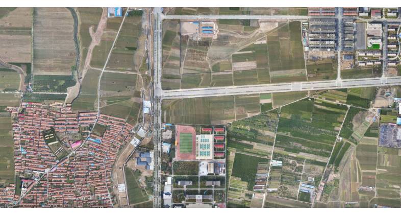
The use of drones into urban planning represents a huge step forward in the manner in which cities are conceived, planned, and administered. The development of drone technology by prominent drone companies, such as those that manufacture DJI drones, has made it possible for urban planners to have access to tools that provide an unprecedented level of precision and flexibility. The use of this technology is especially pertinent in regions that are undergoing rapid development, such as the United Arab Emirates and Dubai, where urban planning needs to be dynamic and sensitive to changes that occur quickly. Listed below is a more in-depth examination of the ways in which drones are transforming urban planning:
Using Drone Technology to Revolutionize the City Modeling Process
Obstacles to Overcome When Modeling Traditional Cities:
As a result of a lack of exact location data, traditional approaches frequently have difficulty synchronizing BIM plans, road vector maps, Google maps, and satellite imagery. Time and personnel costs may be significantly increased as a result of this.
When it comes to providing the spatial information that is required for a comprehensive depiction of urban architecture, 2D designs fall short.
There may be major differences between the reality model and the BIM designs, which can present difficulties in terms of visibility and verification.
What Role Do Drones Play in City Modeling?
Drones make it possible to conduct rapid, automated flights over urban or rural regions in order to collect precise data, which in turn reduces expenses and minimizes the amount of time spent in the field.
Building information modeling (BIM) models can be effortlessly integrated with the geo-referenced, accurate 3D models that are made utilizing drones. This allows for improved display of designs.
In order to improve the efficiency and efficacy of urban planning processes, these three-dimensional models, which were created with photogrammetry software, are compatible with a variety of geographic information system (GIS) applications.
Improvements Made to the Urban-Rural Classification Using Drone Data
Concerns Regarding the Traditional Classification of Urban and Rural Areas:
The conventional classification techniques rely on Google Maps, physical maps, and contour maps, all of which frequently have low resolution, are updated infrequently, and are not intuitive.
The process of mapping is made more difficult by the presence of infrastructure in metropolitan environments that are complex, such as highways, bridges, and water delivery systems.
Since conventional two-dimensional maps do not capture adequate geographic information system (GIS) data for environmental impact analysis, which is necessary for infrastructure development, a three-dimensional model that is more detailed is required.
Benefits of Using Drones in the Classification of Urban and Rural Areas:
Using drones in conjunction with advanced software solutions, various types of geographic information may be combined to produce detailed orthomosaics in two dimensions and three-dimensional models, which can be used for classification and planning purposes.
The utilization of drones allows for the rapid and automated collection of data, which in turn decreases expenses and the number of hours spent in the field.
The fact that the 2D maps and 3D models that are generated with various GIS applications are compatible with one another enables rapid viewing and timely adjustments to be made in the planning process.
The creation of topographic maps for the purpose of extra feature analysis is greatly aided by the use of aerial data obtained from drones.
Enhancing the Efficiency of Maintenance and Inspection Through Corridor Mapping
The process of mapping corridors, such as rivers, bridges, and roadways, is made easier by the use of drones. It is essential for maintenance and inspection operations that they produce accurate models in both two and three dimensions. This application of drones in urban planning is especially beneficial for drone companies that operate in Dubai and the United Arab Emirates, where the creation and maintenance of infrastructure is essential to the growth and functionality of cities.
The Technology of Drones: An Important Part of the Urban Planning Process
Because of the versatility of DJI drones and the innovative nature of drone companies, the usage of drones in urban planning is a testament to both of these qualities. In the context of contemporary urban planning, these drones provide a method of data collecting and model building that is not only accurate but also efficient, cost-effective, and efficient. The ability of these technologies to rapidly cover enormous regions and offer precise representations is causing a transformation in the planning and management of urban areas.
Implications for the Troubleshooting and Maintenance of Drones
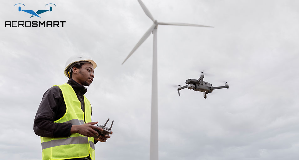
As the use of drones for urban planning becomes more widespread, there has been a corresponding increase in the demand for skilled drone repair and maintenance services. This is especially true in regions such as the United Arab Emirates and Dubai, where the utilization of drone technology in urban development projects is becoming an increasingly prevalent practice. In order to ensure that urban planning projects are finished on schedule, it is essential to have efficient drone repair services that guarantee little downtime and uninterrupted functioning.
Unmanned aerial vehicles (drones) are influencing the future of urban planning.
It can be concluded that drones are playing a significant part in the process of altering urban planning. Their capacity to deliver solutions for data collecting and visualization that are extensive, precise, and provided in a timely manner is quite valuable. The presence of drones, as well as the services provided by drone companies and specialists that specialize in drone repair, will become an increasingly important component of urban planning and development as cities such as those in Dubai and the United Arab Emirates continue to undergo transformations. This technology not only simplifies operations that are already in place, but it also paves the way for new opportunities for environmentally responsible and economically effective city planning and management.
TOP SEARCHING BRANDS
Recent Posts


About
Empowering industries with cutting-edge drone technology, DJI Enterprise solutions, and expert support across the UAE and beyond.
Contacts
-
Address
Office 203, Al Tayer Commercial Building, Rolla Street, Bur Dubai, UAE
-
Phone
+9714 2238380 / +97150 157 6093
-
Email
-
Whatsapp
My Account
Customer Service
Subscribe to our newsletter for regular updates about Offers, Coupons & more
Follow Us
Empowering industries with cutting-edge drone technology, DJI Enterprise solutions, and expert support across the UAE and beyond.
-
Address
Office 203, Al Tayer Commercial Building, Rolla Street, Bur Dubai, UAE
-
Phone
+9714 2238380 / +97150 157 6093
-
Email
-
Whatsapp
