DJI Matrice 400 Dual Gimbal Connector
DJI Matrice 400 Dual Gimbal Connector – Unlock Multi-Sensor Aerial Capabilities
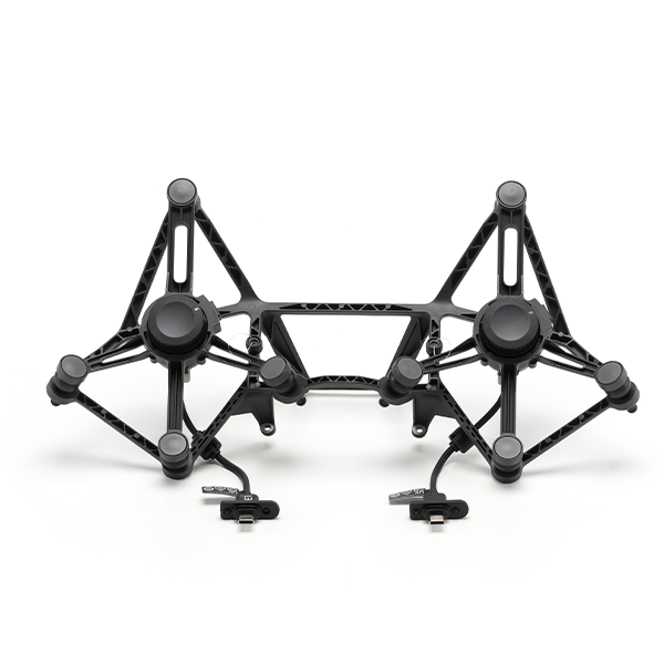
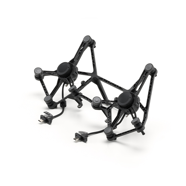
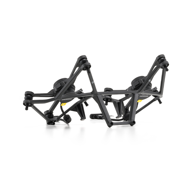
The DJI Matrice 400 Dual Gimbal Connector is a mission-critical accessory that enables the drone to carry two downward-facing gimbal payloads simultaneously. Designed for professionals in industrial inspection, mapping, emergency response, and multisensor data collection, this connector empowers users to operate with greater efficiency, flexibility, and precision—capturing multiple data types in a single flight.
Whether you're combining thermal imaging with visual zoom, or LiDAR mapping with high-resolution photography, the Dual Gimbal Connector expands the drone’s functionality without the need to switch payloads between flights. It is ideal for large-scale projects where time, accuracy, and detailed data are essential.
Key Features
-
Dual Payload Capability
The connector supports two downward gimbal payloads with a combined weight capacity of up to 950 grams. This allows for simultaneous use of zoom, thermal, RGB, or LiDAR sensors—helping teams gather diverse data in real time. -
Third Port Expansion
In addition to the dual downward gimbals, the Matrice 400 supports a third payload port for a heavier sensor or accessory weighing up to 6 kg, enabling even greater customization for enterprise missions. -
Industrial-Grade Design
Precision-engineered to integrate directly with the Matrice 400’s payload ports, the connector maintains flight balance and data stability under high-demand conditions. It is designed to perform reliably in rugged environments across various industrial use cases. -
Efficient Data Capture
By supporting multi-sensor workflows, the Dual Gimbal Connector eliminates the need for repetitive flights. This reduces mission time and costs, while improving operational accuracy and response speed.
Applications
1. Infrastructure & Utilities Inspection
Capture visual and thermal images in one flight to assess structural integrity, overheating components, and material fatigue. Ideal for inspecting powerlines, oil and gas pipelines, bridges, and wind turbines.
2. Search and Rescue / Public Safety
Deploy thermal and zoom sensors together to locate missing persons, assess fire zones, or manage crowd monitoring with real-time intelligence. The dual payload configuration enhances visibility and situational awareness in crisis response.
3. Surveying & Mapping
Use a combination of RGB and LiDAR sensors to produce accurate 2D and 3D maps, point clouds, and terrain models. This is particularly valuable for topographic studies, land development, and environmental monitoring.
4. Agriculture & Forestry
Combine multispectral or thermal sensors with high-resolution cameras to conduct crop health analysis, detect irrigation issues, and map vegetation cover for sustainable land management.
Reviews & Ratings
Related products

DJI Matrice 30T With BS30

")


DJI Matrice 350 TB65 Intelligent Flight Battery

DJI Flycart 30


Product Queries (0)
Login or Registerto submit your questions to seller
Other Questions
No none asked to seller yet
Top Selling Products

Osmo Pocket 3 Creater Combo

DJI Matrice 4 Series Battery
")
DJI Mini 5 Pro Fly More Combo (DJI RC 2)

DJI Neo 2 Motion Fly More Combo

DJI Neo 2 Fly More Combo

DJI Neo 2
Top Selling Products
Osmo Pocket 3 Creater Combo
DJI Matrice 4 Series Battery
DJI Mini 5 Pro Fly More Combo (DJI RC 2)
DJI Neo 2 Motion Fly More Combo
DJI Neo 2 Fly More Combo
DJI Neo 2
About
Empowering industries with cutting-edge drone technology, DJI Enterprise solutions, and expert support across the UAE and beyond.
Contacts
-
Address
Office 203, Al Tayer Commercial Building, Rolla Street, Bur Dubai, UAE
-
Phone
+9714 2238380 / +97150 157 6093
-
Email
-
Whatsapp
My Account
Customer Service
Subscribe to our newsletter for regular updates about Offers, Coupons & more
Follow Us
Empowering industries with cutting-edge drone technology, DJI Enterprise solutions, and expert support across the UAE and beyond.
-
Address
Office 203, Al Tayer Commercial Building, Rolla Street, Bur Dubai, UAE
-
Phone
+9714 2238380 / +97150 157 6093
-
Email
-
Whatsapp